The Lake District is England's hiking heart — 214 named fells in 880 square miles, the country's most concentrated mountain terrain south of the Scottish border, and a walking tradition that runs from Wordsworth and Coleridge through Wainwright to the modern Coast to Coast pilgrimage. This is your complete guide to hiking in the Lake District: which routes are worth the trip, how to pick the right one for you, and what the weather, transport and kit reality actually looks like once you're there.
At a glance
| Routes in this guide | 2 (Coast to Coast + Pennine Way western section); ~50 named fell walks beyond |
| Distance range | 4 miles (Cat Bells) to 192 miles (Coast to Coast) |
| Difficulty range | Easy (lake-edge paths) to expert (Scafell Pike, Striding Edge) |
| Best season | May, June, September — April and October for shoulder quiet |
| Base towns | Keswick, Ambleside, Grasmere, Coniston, Wasdale Head |
| Train access | Windermere (Lakes Line); Penrith / Oxenholme for connections |
| Best long-distance route | Coast to Coast Hike |
Why hiking in the Lake District is different
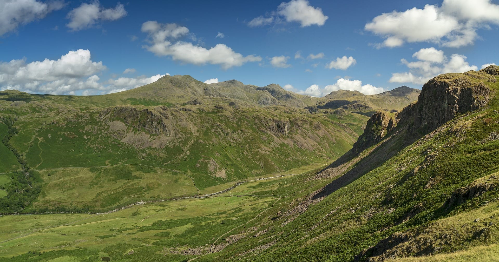
Three things make the Lake District unlike anywhere else in England. First, the rock. Volcanic lava and ash from the Borrowdale Volcanic Group laid down 450 million years ago gives the central Lakes their rugged, broken character — sharp ridges, scree slopes, the kind of landscape that looks Alpine on a misty day. Second, the water. Sixteen named lakes, 200 tarns, and 3.3 metres of annual rainfall at Seathwaite (England's wettest inhabited place) mean the valleys are full of rivers, becks, waterfalls and quick-changing weather. Third, the cultural density. Wainwright's seven Pictorial Guides catalogued every fell with a 30-year obsession; the Coast to Coast Walk he devised in 1973 is now walked by more than 20,000 people a year. The Lake District has the longest, deepest hiking tradition of any English landscape.
The scale is deceptive. Scafell Pike is England's highest peak at 978 metres — the same height as a small Munro — and the central fells regularly produce winter conditions that require ice axe and crampons. The popular Helvellyn-via-Striding-Edge route claims 2-3 fatalities a year, mostly from underestimating the route in autumn rain or unprepared winter ascents. The fells aren't Snowdon-massive or Scottish-remote, but they're real mountains with real weather and real consequences.
What's also true: you can spend a week here doing 6-mile lake-edge walks and never break out of trainers. The walking culture is full-spectrum. Wordsworth's daffodil-edge ambles, Wainwright's fell-bagging, the family Sunday lap of Tarn Hows, and the all-day scramble across the Crinkle Crags ridge all coexist on the same network of paths. Lake District National Park Authority keeps roughly 3,200km of public footpaths maintained.
The routes worth knowing in this guide
| Route | Distance | Total ascent | Days | Character |
| Coast to Coast Hike | 192 miles | ~8,000m total | 12-14 | The headline. Lakes are the first third; hardest section. |
| Pennine Way (eastern Lakes edge) | 12 miles of relevance | ~600m | 1-2 days | High Pennine routes touch the eastern Lake District |
Beyond the National Trail routes, the Lake District holds about 50 classic day-walks and ridge traverses worth a serious mention. The Helvellyn horseshoe via Striding Edge and Swirral Edge (8 miles, 950m ascent, Grade 1 scramble in places); the Scafell Pike round from Wasdale (6 miles, 950m ascent, rocky); the Old Man of Coniston (5 miles, 700m ascent, gentler); the Catbells-Maiden Moor-High Spy ridge from Keswick (8 miles, 600m ascent, the standard "first proper Lake District walk"); the Fairfield Horseshoe from Ambleside (10 miles, 900m ascent, classic ridge); the High Street Roman road traverse (variable, 700-1000m, atmospheric); and the Langdale Pikes round from Old Dungeon Ghyll (7 miles, 800m ascent, dramatic). These aren't yet listed individually in the directory but they're the names anyone planning a Lakes hiking week should know.
How to choose the right Lake District hike for you
First time in the fells? Start with Cat Bells.
Cat Bells from Keswick is the standard introduction to the Lake District — a 4-mile horseshoe ridge with one of the best views in England for the effort required. Park or bus to Hawes End, follow the obvious path up the ridge, drop into Manesty for the return along the lakeshore. Two to three hours, no scrambling, a real summit feel. If that goes well, Loughrigg Fell from Ambleside or the Old Man of Coniston are the natural next steps.
Got a weekend? Walk the Catbells-Maiden Moor-High Spy ridge or the Fairfield Horseshoe.
The 8-mile Catbells extension along the Borrowdale ridge gives a full day's ridge walking, returning along Derwentwater by ferry. The Fairfield Horseshoe from Ambleside is the harder weekend option — 10 miles, 900m of ascent, a classic round of nine summits. Both leave time for a pub stop and a second day's lake-edge walk.
Multi-day? The Lake District section of the Coast to Coast.
The first four days of the Coast to Coast (St Bees to Patterdale) cover 60 miles and 4,000m of ascent through Ennerdale, Borrowdale and Patterdale — the most concentrated mountain country on the route. Baggage transfer services run the full Coast to Coast; the Lakes-only section is a defensible four-day micro-trip in its own right.
Looking for a serious mountain experience? Scafell Pike via the Corridor Route or Helvellyn via Striding Edge.
Scafell Pike (978m, England's highest) is best approached from Wasdale Head via the Corridor Route — longer than the standard tourist path from Borrowdale, but takes in the high mountain scenery of Lingmell Col and Hollow Stones. Helvellyn (950m) via Striding Edge is the country's most famous Grade 1 scramble; in dry summer conditions it's walkable in trainers, but the exposed sections are unforgiving in wind or wet. Both routes require map-reading competence and a careful read of the forecast.
When to go: Lake District hiking by season
May and June are the unequivocal best months — long daylight (16+ hours), settled weather windows, fells dry enough for trainers, no midges yet at altitude. Most Lake District photographers shoot in May. July and August are warmer but busier — the popular paths (Helvellyn, Scafell Pike, Cat Bells) get genuinely crowded on weekends, parking fills by 8am at Wasdale and Honister, and midges arrive at evening lake-edge. September is the quiet repeat of June — arguably the single best month of the year for serious fell walking. October brings autumn colour (Borrowdale and Buttermere are showstoppers) but rain doubles from late September.
November to March is genuine winter on the high tops — ice and snow on Scafell, Helvellyn, Skiddaw and the Langdale Pikes from December to mid-March in most years. Ice axe and crampons are not optional above 600m in those months. The lower lake-edge walks (Buttermere, Tarn Hows, Loughrigg) are walkable year-round.
The single worst month is statistically October — the highest combination of rainfall, fading daylight, and pre-winter cold. February has fewer day-light hours but better weather odds.
Getting to the Lake District without a car
Train: Windermere is the only station inside the Lake District National Park, reached from Oxenholme on the West Coast Main Line (Avanti West Coast from London Euston, ~3h direct). Penrith is the eastern alternative — closer to Ullswater, Patterdale and the eastern fells. Bus: the Stagecoach 555 service runs Lancaster — Kendal — Windermere — Ambleside — Grasmere — Keswick year-round (multiple services daily, top-deck views included). The 599 covers Bowness-Hawkshead-Coniston in summer. The X4/X5 from Penrith handles the eastern Lakes. Wasdale Head, the most dramatic valley, has no public transport in winter and only sparse summer-only services; a local taxi from Gosforth is the practical option. Many fell walks start within walking distance of bus stops — the Stagecoach Lakes day-ticket pays for itself in two journeys.
Where to base yourself
Keswick is the central hub — equally close to Derwentwater, Borrowdale, Skiddaw, Helvellyn and Buttermere. Best bus connections of any base town. Best for first-time visitors. Ambleside is the southern alternative — lake-end of Windermere, close to Fairfield, the Langdales and Coniston. Most outdoor shops; best café scene. Grasmere sits between Keswick and Ambleside — smaller and quieter, the literary Lakes base (Wordsworth's Dove Cottage). Coniston is the south-western quiet option — access to the Old Man, the Yewdale fells, and gentler family walking. Wasdale Head is the high-mountain base — only one road in, the Wasdale Head Inn at the trailhead, walking-in distance to Scafell Pike. The accommodation books out months ahead in summer.
Kit specific to the Lake District
Three pieces of kit matter more here than on most UK hill ranges. Waterproof boots — not just shoes — because Lake District paths cross rivers, traverse boggy plateau, and run wet for half the year. A proper waterproof shell with a hood (Gore-Tex Pro or equivalent), not a packable rain jacket — the Lakes routinely produce 60mph wind on the tops in winter and the wind drives the rain horizontally. A map and compass on every walk above 500m, because the cloud descends fast and the path network is dense enough that wrong-turning is genuinely easy. OS Maps app subscription (or paper 1:25,000 Explorer sheets OL4, OL5, OL6, OL7) covers the National Park in four maps. Mountain Weather Information Service (mwis.org.uk) is the single forecast that mountain professionals actually use; check it before every walk above 600m. For winter mountaineering kit considerations and route conditions, the Lake District Mountain Forecast from the Met Office covers the same ranges.
Common questions about hiking in the Lake District
What is the best hike in the Lake District for beginners?
For a first proper Lake District walk, Cat Bells from Keswick is the standard starter — a 4-mile horseshoe ridge with one of the best views in England for the effort required. For something longer, the Catbells-to-Maiden Moor extension or the Old Man of Coniston are both good next steps. Avoid Helvellyn via Striding Edge as a first walk — it has genuine exposure that catches first-timers out.
How long does the Lake District section of the Coast to Coast take?
The Lake District section of Wainwright's Coast to Coast Walk runs from St Bees on the Cumbrian coast through Ennerdale, Borrowdale and Patterdale — roughly the first 60 miles of the 192-mile route, typically walked in 4-5 days. It's the hardest section of the whole route: most of the route's 8,000m of total ascent is concentrated here.
Can you hike in the Lake District without a car?
Yes, but with planning. Windermere is the only Lake District railway station; from there the 555 bus serves Keswick (the main hiking base) and the 599 serves Hawkshead, Coniston and Bowness. The X4/X5 from Penrith covers the eastern Lakes (Patterdale, Glenridding). Wasdale Head, the most dramatic valley in the Lakes, has no public transport in winter and a sparse summer-only service.
When is the worst time to hike in the Lake District?
November and February are the toughest months — short daylight, heavy rain on the western tops, and snow on Helvellyn, Scafell and the Langdale Pikes that requires ice-axe-and-crampons winter mountaineering skill. December and January are paradoxically better if you get a settled cold spell: short days but clear views. The wettest single month historically is October.
Is Striding Edge dangerous?
Striding Edge is a Grade 1 scramble on Helvellyn — exposed in places (a fall on the wrong section is fatal), but on a dry summer day with no high winds it's walkable in trainers by anyone with a head for heights. The main hazards are wet rock, winter ice, and high wind. The annual fatality count on Helvellyn averages 2-3 per year; most are from slips on the wet rock in autumn or unprepared winter ascents in February-March.
What else is in this region
If you're spending a week in or near the Lake District, the directory has plenty of complementary activity beyond the hiking. Lake District rock climbing covers the classic mountain crags — Scafell, Pillar, Pavey Ark, Shepherd's Crag — some of the most atmospheric climbing in Britain. Whinlatter Forest Park MTB is the only true mountain MTB centre in England, above Bassenthwaite Lake near Keswick. For an alternative angle on Northern England, see the Northern England region page which gathers everything in the Lakes, Peaks, Dales and Northumberland in one view. Or jump sideways to Hiking in Scotland once you're ready for Munros, or Hiking in the Peak District for the gritstone country to the south.
Related guides
Planning the practicalities? See the best time of year to walk each National Trail, how to walk them car-free, and where you can legally wild camp in the UK.
More Lake District adventures
The Lakes are not only for walkers — across the directory you will also find wild swimming at Buttermere, paddleboarding on Coniston Water, kayaking on Derwentwater, wild camping at Wasdale and the climb up Scafell Pike — each with its own page, directions and access notes.
Where to hike
in the Lake District.
Plan it yourself.
The most authoritative sources we know of for this route — routes, conditions, governing bodies and operators. Open in a new tab.
- National Trails official body for the 15 long-distance National Trails of England and Wales.
- OS Maps Ordnance Survey for paper sheets and the OS Maps app for route planning.
- Mountain Weather Information Service free upland weather forecasts — the standard reference for British hill walkers.
- Long Distance Walkers Association route database covering hundreds of UK long-distance trails beyond the National Trails network.