Route notes checked June 2026.
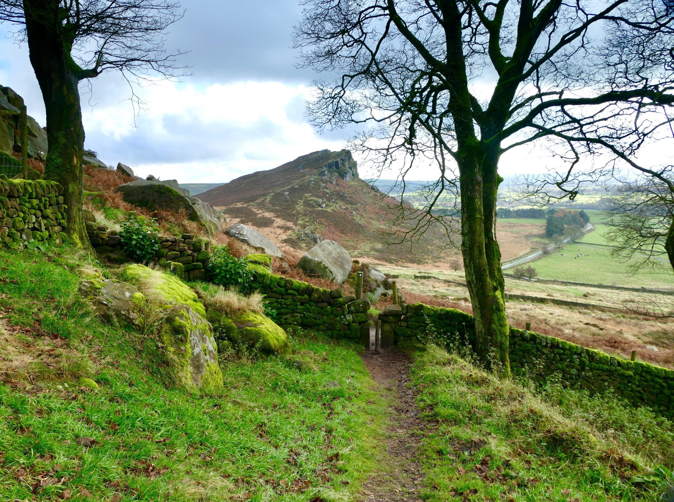
The Pennine Way runs 268 miles along the rocky spine of England, from Edale in the Peak District to Kirk Yetholm just over the Scottish border. It opened in 1965 as Britain's first long-distance National Trail and it still sets the bar — physically demanding, weather-exposed, and routed through some of the wildest landscape England has.
What to expect
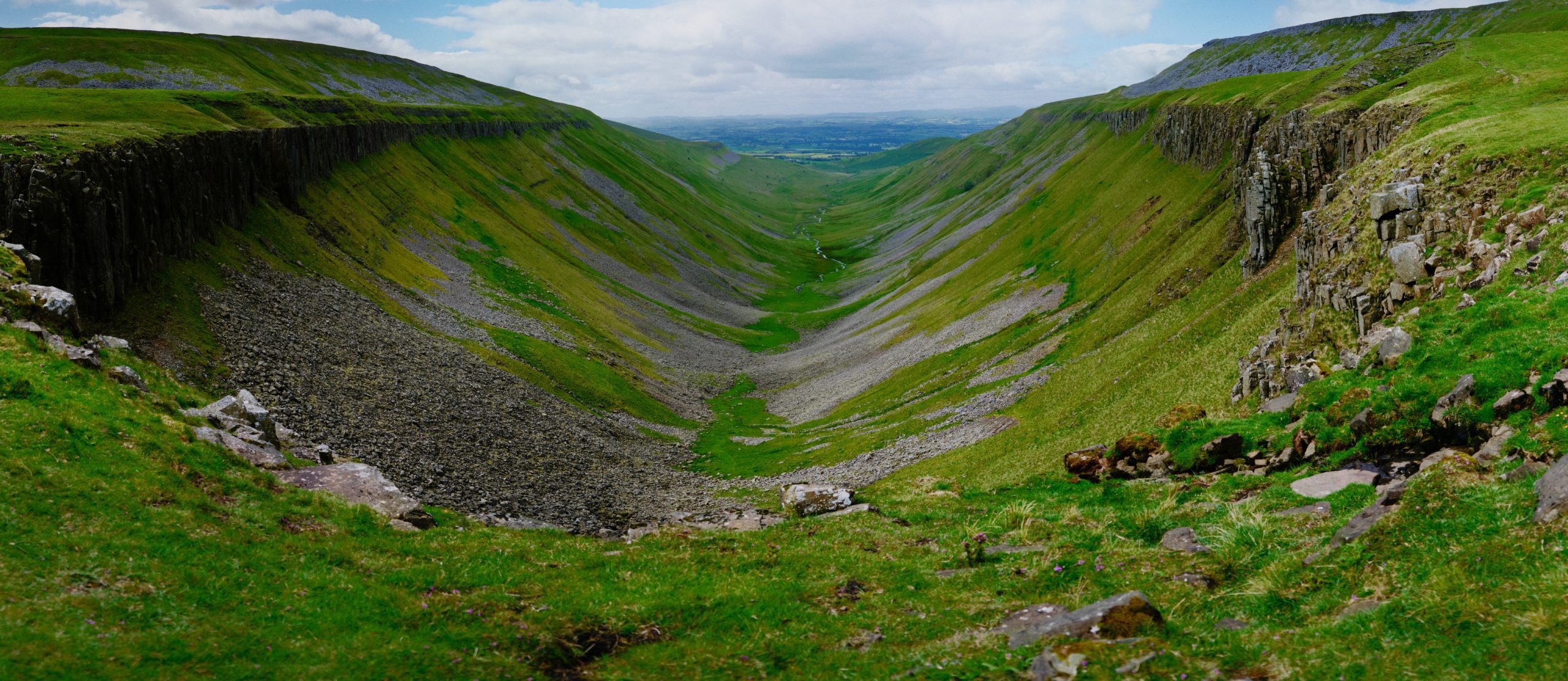
Roughly 16-19 days at a steady pace, with around 11,000m of total ascent — more than the height of Everest from sea level. The terrain shifts from gritstone edges in the Peak, through the limestone country of the Yorkshire Dales, over the bleak high moors of the North Pennines, along Hadrian's Wall, and finally into the rolling Cheviots. Most days have at least one section of saturated peat bog. Conditions can flip from sun to driving rain inside an hour.
Practical notes
Best walked May through September; serious winter undertaking outside that window. Accommodation runs from bunkhouses and B&Bs to the official Pennine Way camping barns. Bring proper waterproofs, gaiters, and a map and compass — the high moor sections will be in cloud often enough that you'll need them. Most walkers go south to north; a few do it in two-week chunks across multiple seasons.
Stage by stage
The Pennine Way runs 268 miles up the spine of England, south to north, from Edale in the Peak District to Kirk Yetholm just over the Scottish border. It is the oldest and hardest of the National Trails — boggy, remote and weather-exposed. Broken into natural sections it looks like this (mileages are approximate; this is genuinely tough ground, so daily distances run shorter than on gentler trails):
| Section | Distance | Days | Character |
|---|---|---|---|
| Edale to Malham | ~48 miles | 3 | Kinder Scout and the dark peat moors of the Peak District, easing into the white limestone country around Malham Cove. |
| Malham to Hawes | ~37 miles | 2–3 | Malham Cove, Pen-y-ghent and the Three Peaks country of the Yorkshire Dales. Horton-in-Ribblesdale on the way has a station on the Settle–Carlisle line. |
| Hawes to Middleton-in-Teesdale | ~38 miles | 2–3 | Great Shunner Fell, Tan Hill (Britain's highest pub) and the waterfalls of upper Teesdale. |
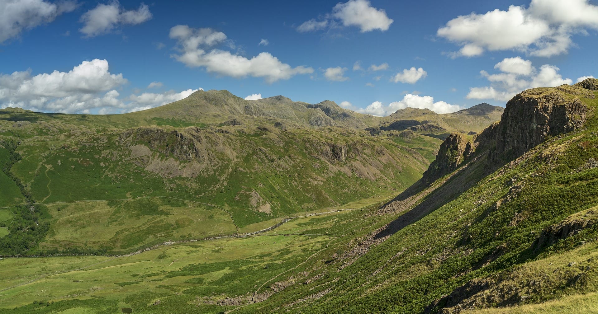
| Middleton-in-Teesdale to Alston | ~40 miles | 3 | High Force and High Cup Nick, then the hardest day on the trail over Great Dun Fell and Cross Fell — at 893m the Pennine Way's high point and the highest ground in England outside the Lake District. |
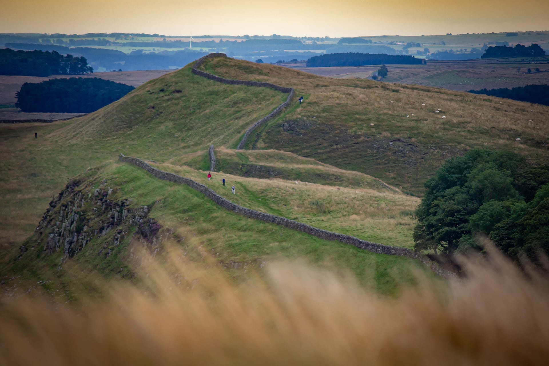
| Alston to Bellingham | ~43 miles | 2–3 | The South Tyne valley, a crossing of Hadrian's Wall and the lonely edge of the Northumberland forests. |
| Bellingham to Kirk Yetholm | ~42 miles | 2–3 | The empty Cheviots and the notoriously long final crossing to the Scottish border at Kirk Yetholm. |
Doing it car-free
The two ends are unequal. The start at Edale has its own station, with direct trains from Manchester and Sheffield on the Hope Valley line — about as easy a start as any big trail offers. The finish at Kirk Yetholm has no railway at all; the nearest station is Berwick-upon-Tweed on the East Coast Main Line, reached by bus via Kelso.
In between, the Pennine Way is more rail-served than its wild reputation suggests. The Settle–Carlisle line gives you stations at Horton-in-Ribblesdale, Garsdale (for Hawes) and Langwathby (for the Cross Fell section), so the trail divides naturally into rail-accessible chunks if you would rather walk it over several trips than in one push.
See how the Pennine Way's mixed transport access compares across the network in our car-free National Trails index.
Where to stay
Accommodation is thinner and more spread out than on the southern trails, and booking ahead is essential rather than optional — in several places there is only one realistic stop for the night. Walkers use a mix of pubs with rooms, bunkhouses, hostels and B&Bs, with bag-transfer services available for most of the route. Some of the high crossings have no shelter or supplies for many miles, so carry food and full waterproofs even in summer.
Quick answers
How long does the Pennine Way take?
Most people take 16–19 days for the full 268 miles. Strong, experienced walkers do it in around two weeks; many sensibly break it into rail-accessible sections over several years instead.
Is the Pennine Way really the hardest National Trail?
By common agreement, yes — not for its height but for the relentless distance, the exposure and the peat bog. It demands navigation skills and proper hill kit in a way the southern trails do not.
Can you walk it without a car?
The start at Edale is easy by train; the finish at Kirk Yetholm needs a bus to Berwick-upon-Tweed. The Settle–Carlisle line makes the central Dales and Pennines unusually accessible for section walkers.
When is the best time to walk it?
Late spring to early autumn. May and June give the driest ground and longest days; the peat moors are at their worst after prolonged rain, and winter brings serious mountain conditions to Cross Fell and the Cheviots.
Train, parking, drive…
- Train
- Edale (Hope Valley line), 5 min walk to trailhead at the Nag's Head
- Return
- Kirk Yetholm (bus to Kelso, train via Berwick-upon-Tweed)
- Parking
- Edale National Park car park; can fill on summer weekends
- Postcode
- S33 7ZD
- Drive
- ~3h30 from London, ~1h from Sheffield/Manchester
- Car-free?
- Easy
Transport details are best-effort and worth double-checking on the day — rural buses and station services change with the timetable.
If you’ve got an extra day…
Plan it yourself.
The most authoritative sources we know of for this route — routes, conditions, governing bodies and operators. Open in a new tab.
- Pennine Way - National Trails
- National Trails official body for the 15 long-distance National Trails of England and Wales.
- OS Maps Ordnance Survey for paper sheets and the OS Maps app for route planning.
- Mountain Weather Information Service free upland weather forecasts — the standard reference for British hill walkers.
- Long Distance Walkers Association route database covering hundreds of UK long-distance trails beyond the National Trails network.