The Cotswolds is the gentlest National Trail in England and the most walkable Area of Outstanding Natural Beauty in the country — 102 miles of limestone escarpment from Chipping Campden in north Gloucestershire to Bath, through honey-coloured stone villages, beech woodland and rolling sheep country that has barely changed in 400 years. It opened as a National Trail in 2007 (though sections have been walked for far longer), drains better than any equivalent hill route, and finishes in a city with the country's only thermal springs. This is your complete guide to hiking in the Cotswolds: routes, pacing, transport, kit, and which sections to walk if you can't do the whole thing.
At a glance
| Routes in this guide | 1 National Trail (The Cotswold Way Hike) + day-walk sections |
| Distance range | 6 miles (a day section) to 102 miles (full Cotswold Way) |
| Difficulty range | Easy throughout — the gentlest UK National Trail |
| Best season | Year-round, but May, June, September best; winter genuinely walkable too |
| Highest point | Cleeve Hill, 330m |
| Base towns | Chipping Campden, Broadway, Painswick, Stroud, Bath |
| Train access | Moreton-in-Marsh (north end); Bath Spa (south end); GWR Cotswold Line throughout |
Why hiking in the Cotswolds is different
The Cotswolds isn't a mountain range and the Cotswold Way doesn't pretend to be a mountain route. It's the antithesis of Lake District or Snowdonia walking — gentle elevation, civilised infrastructure, accommodation every 8-12 miles, and a path system that prioritises scenery over altitude. The highest point is Cleeve Hill at 330m. The total ascent for the full 102-mile route is roughly 1,500m, less than a single Lake District day. This is walking as moving meditation, not as endurance test.
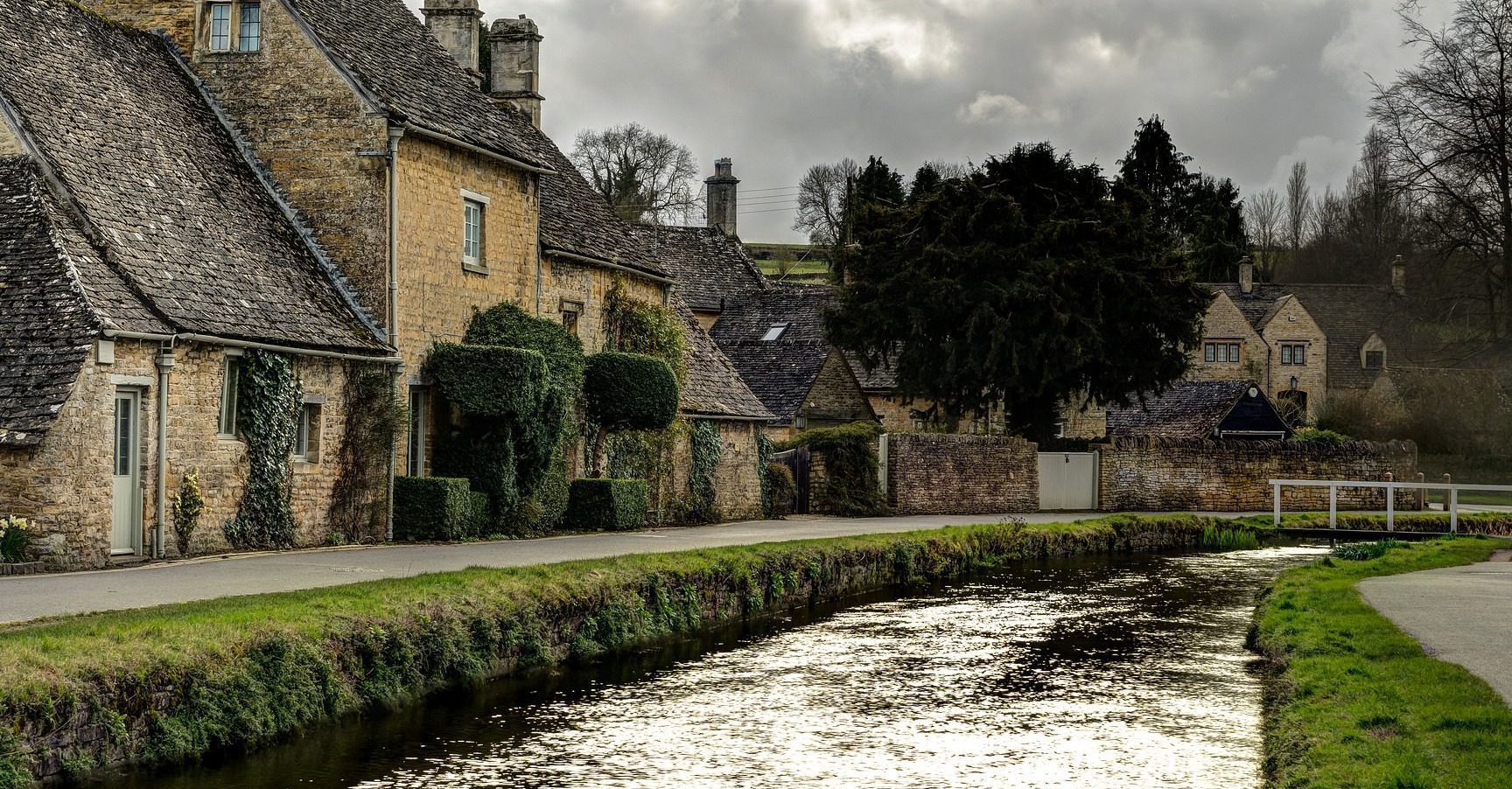
What makes the Cotswolds genuinely special and worth a dedicated guide is what the route runs through. The limestone escarpment is the western edge of an Oolitic limestone plateau laid down in the Jurassic period — warm honey-coloured stone (called "Cotswold stone" in local builders' merchants for 300 years) that gives the villages their distinctive look. The villages themselves — Chipping Campden, Stanton, Broadway, Stanway, Winchcombe, Painswick, Stroud — are some of the best-preserved Tudor and Stuart settlements in England, partly because the medieval wool trade made them rich, partly because the railway lines passed them by in the 1840s.
The hiking culture is gentler too. This is the National Trail you can walk with grandparents, the one where the daily decision is whether to push to the next village or stop at the pub three miles in, the one where carrying a tent feels overkill because there's a B&B at the next milestone. Cotswold Way Association keeps the path well-marked; the Cotswolds Conservation Board manages the wider AONB.
What it's not is wild country. Don't come to the Cotswolds expecting the silence of the Northumberland Cheviots or the remoteness of mid-Wales. You'll cross roads, pass cottages, share fields with sheep, and hear traffic from the M5 on the western escarpment sections. The compensation is the architecture and the agriculture — the country at its most cultivated, in the best sense.
The Cotswold Way: route worth walking
| Section | Distance | Days | Character |
| Chipping Campden — Broadway | 6 miles | 1 (day-trip) | Best northern day; Broadway Tower; widest single view |
| Broadway — Winchcombe | 11 miles | 1 | Stanton, Stanway, Hailes Abbey ruins; classic Cotswold villages |
| Winchcombe — Cheltenham | 12 miles | 1 | Belas Knap long barrow; Cleeve Hill (highest point); racing country |
| Cheltenham — Painswick | 16 miles | 1-2 | Crickley Hill, Cooper's Hill (the cheese-rolling field), Birdlip |
| Painswick — Stroud | 8 miles | 1 | Selsley Common; the Five Valleys panorama; wildflower commons |
| Stroud — Wotton-under-Edge | 12 miles | 1-2 | Coaley Peak (panorama), Nympsfield Long Barrow, Tyndale Monument |
| Wotton — Old Sodbury | 12 miles | 1 | Hawkesbury Monument; quieter southern country |
| Old Sodbury — Bath | 17 miles | 1-2 | Dyrham Park, Lansdown ridge; spectacular Bath descent |
Most walkers do the full 102 miles in 7-10 days. The standard division is 7 days for fit walkers (averaging ~14 miles a day), 8-9 days for the more comfortable pace, or 10+ for the leisurely literary-pub crawl. Several sections work as standalone day-walks — the Chipping Campden to Broadway northern section and the Painswick to Stroud southern section are both genuinely beautiful one-day options for visitors based in nearby market towns.
How to choose the right Cotswold hike for you
First long walk in the UK? Walk the whole thing.
The Cotswold Way is the kindest UK National Trail to first-time long-distance walkers. Daily mileage is achievable. Accommodation is plentiful (book 2-3 months ahead for May-September). Underfoot is forgiving — well-drained limestone, very little bog, mostly path rather than rough ground. The route is well-marked with the acorn signage and the Cotswold Way emblem. You can carry a 10-litre day pack and have your bag transferred between B&Bs by one of several baggage services. It's the National Trail to start your long-distance walking career on.
Day-trippers from London? Chipping Campden to Broadway.
A 6-mile linear walk from Chipping Campden (train to Moreton-in-Marsh, bus to Chipping Campden) to Broadway, taking in Broadway Tower at the high point and one of the longest single views on the National Trail. Stay overnight in either village or train back from Moreton. Approximately 5 hours' walking with a long lunch stop.
Looking for the prettiest single section? Painswick to Stroud.
8 miles, two villages, Selsley Common (wildflower-rich limestone grassland), and the Five Valleys panorama from Selsley Hill — arguably the single most photographed view on the trail. Both ends accessible by train (Stroud is on the GWR Cotswold Line).
Want quiet sections? Walk the southern half.
The northern Cotswolds get the traffic — Broadway, Stanton, Stanway, Bourton-on-the-Water (just off-route), Bibury and Lower Slaughter are some of the most-photographed villages in England. The southern half from Painswick onwards is significantly quieter — Wotton-under-Edge, Hawkesbury, Old Sodbury, Cold Ashton — while crossing equally beautiful country with a fraction of the foot traffic. The full route ending in Bath rewards walkers who push through the quieter middle.
When to go: Cotswolds hiking by season
April to October covers the conventional season, but the Cotswolds is genuinely walkable year-round. April brings bluebell woods (Beechwood between Painswick and Stroud is famous), lambing, and the longest daylight stretch before the summer crowds. May and June are peak season — warmest weather, longest daylight, wildflowers on the limestone commons, all the village pubs at full strength. July and August are warm and busy — the popular villages get crowded with day-trippers, but the National Trail itself rarely feels pressed. September is the photographer's favourite — honey-stone in golden light, harvest in the fields, hedgerow blackberries.
October and November bring autumn colour through the beech woods. The Cotswold Way drains better than almost any other long-distance trail in winter — limestone underfoot doesn't turn to clay slush the way Pennine peat does. December to March works fine for the trail itself if you have the kit; the trade-off is shorter days (5pm sunsets in December) and thinner accommodation (some seasonal B&Bs close November to March). The standard advice is: walk between 9am and 4pm, book ahead, and you'll have the trail almost to yourself.
The single best week to walk is the second or third week of May — bluebells past peak in the woods but still abundant, longest daylight before the summer school holidays, daffodils gone but limestone wildflowers in full bloom.
Getting to the Cotswolds without a car
The GWR Cotswold Line (London Paddington to Worcester via Oxford, Charlbury, Kingham, Moreton-in-Marsh and Honeybourne) is the rail spine of the northern Cotswolds — an hour and a half from London to Moreton-in-Marsh, with onward bus to Chipping Campden for the trailhead. For the southern half: GWR Bristol-Birmingham line via Cheltenham, Stonehouse and Stroud; mainline London Paddington to Bath Spa for the southern terminus. Several sections of the trail are walkable as one-way day-walks between two stations on the same line (Chipping Campden — Broadway; Stroud — Stonehouse; Bath Spa — Cold Ashton). The Cotswold Way Association maintains a comprehensive public transport guide on their National Trails site — the standard reference.
Where to base yourself
Chipping Campden is the northern trailhead — pretty market town, multiple B&Bs and inns, the start cairn at the foot of Dover's Hill. Broadway sits 6 miles south — busier in summer, more accommodation, Broadway Tower 2 miles up the hill. Stroud is the southern Cotswolds hub — train-accessible, the Five Valleys at the doorstep, more workaday than picture-postcard. Bath is the southern terminus and a destination city in its own right — thermal baths, Roman ruins, Georgian architecture, plenty of accommodation. Painswick is the smaller mid-trail base — "the Queen of the Cotswolds" by local marketing, Painswick Beacon walks above the village. Winchcombe is the second northern base — quieter than Broadway, Sudeley Castle adjacent, the natural lunch stop on the Cheltenham approach.
Kit specific to the Cotswolds
The Cotswold Way is the most forgiving UK National Trail for kit. A 25-litre day pack with water, lunch, a waterproof jacket, a thin spare layer, hat, and your usual phone-and-keys covers any single day on the trail in any month. Boots aren't strictly necessary — trail shoes are fine in dry conditions, walking shoes in winter. The local OS map sheets are Explorer OL45 (the Cotswolds) and OL44 (Cotswolds west). The National Trails Cotswold Way pages give official path conditions and any temporary diversions. The trail is so well-signed with the acorn waymark and the Cotswold Way crest that map-and-compass navigation is rarely needed; bring them anyway for the off-route exploring you'll inevitably do.
Common questions about hiking in the Cotswolds
How long does the Cotswold Way take to walk?
The Cotswold Way runs 102 miles from Chipping Campden in north Gloucestershire to Bath, typically walked in 7-10 days. It opened as a National Trail in 2007 and follows the limestone escarpment's western edge — easy underfoot, well-signed, with B&B accommodation every 8-12 miles. It's the most beginner-friendly long-distance National Trail in England.
Are there mountains in the Cotswolds?
No, by any honest definition — the highest point is Cleeve Hill at 330m. The Cotswolds are an Area of Outstanding Natural Beauty (AONB), not a mountain range. What they offer is the country's most extensive surface of well-walked limestone hills, gentle escarpment scenery, and stone villages that genuinely look like the postcards. For mountains within day-trip range, look at the Brecon Beacons (south) or the Peak District (north).
What's the best section of the Cotswold Way for a day walk?
Two stand out. Northern: Chipping Campden to Broadway (6 miles), with Broadway Tower and the longest single hill view on the trail. Southern: Painswick to Stroud via Selsley Common (8 miles), with the Five Valleys panorama and the wildflower-rich common land of the upper Frome. Both are walkable as one-way day trips from London via train.
Can I walk the Cotswold Way in winter?
Yes — the Cotswold Way is one of the most walkable winter National Trails because the limestone underfoot drains better than most. Expect mud on the lower farmland sections after rain and slick stiles on a frost; expect clear, photographer-favourite light on cold sunny days. The standard accommodation B&B network thins from November to March; book ahead and consider the GWR rail spine to break the walk into day-trip sections.
Where do most people start the Cotswold Way?
Most walkers start at Chipping Campden in the north and walk south to Bath — this puts the prevailing wind at your back, gives you Bath as a celebratory finish, and means train access is easier at the end (Bath Spa is a 90-minute direct from London Paddington). North-to-south is the convention; south-to-north works but feels less rewarding.
What else is in this region
The Cotswolds rewards a slow week. Beyond the Way itself, Forest of Dean mountain biking sits 30 minutes west across the Severn for the trail-centre option. Cheddar Gorge rock climbing is a 90-minute drive south through Somerset for sport climbing on England's largest limestone gorge. For Bath-end visitors, Cloudbase paragliding near Hungerford runs an hour east. For broader regional view see South-West England (the lower Cotswolds bleed into this rollup) or Central & Eastern England (the northern Cotswolds). Or step up to mountain country with Hiking in the Peak District or Hiking in the Lake District for genuine altitude.
Related guides
Planning the practicalities? See the best time of year to walk each National Trail, how to walk them car-free, and where you can legally wild camp in the UK.
Where to hike
in the Cotswolds.
Plan it yourself.
The most authoritative sources we know of for this route — routes, conditions, governing bodies and operators. Open in a new tab.
- National Trails official body for the 15 long-distance National Trails of England and Wales.
- OS Maps Ordnance Survey for paper sheets and the OS Maps app for route planning.
- Mountain Weather Information Service free upland weather forecasts — the standard reference for British hill walkers.
- Long Distance Walkers Association route database covering hundreds of UK long-distance trails beyond the National Trails network.