Route notes checked June 2026.
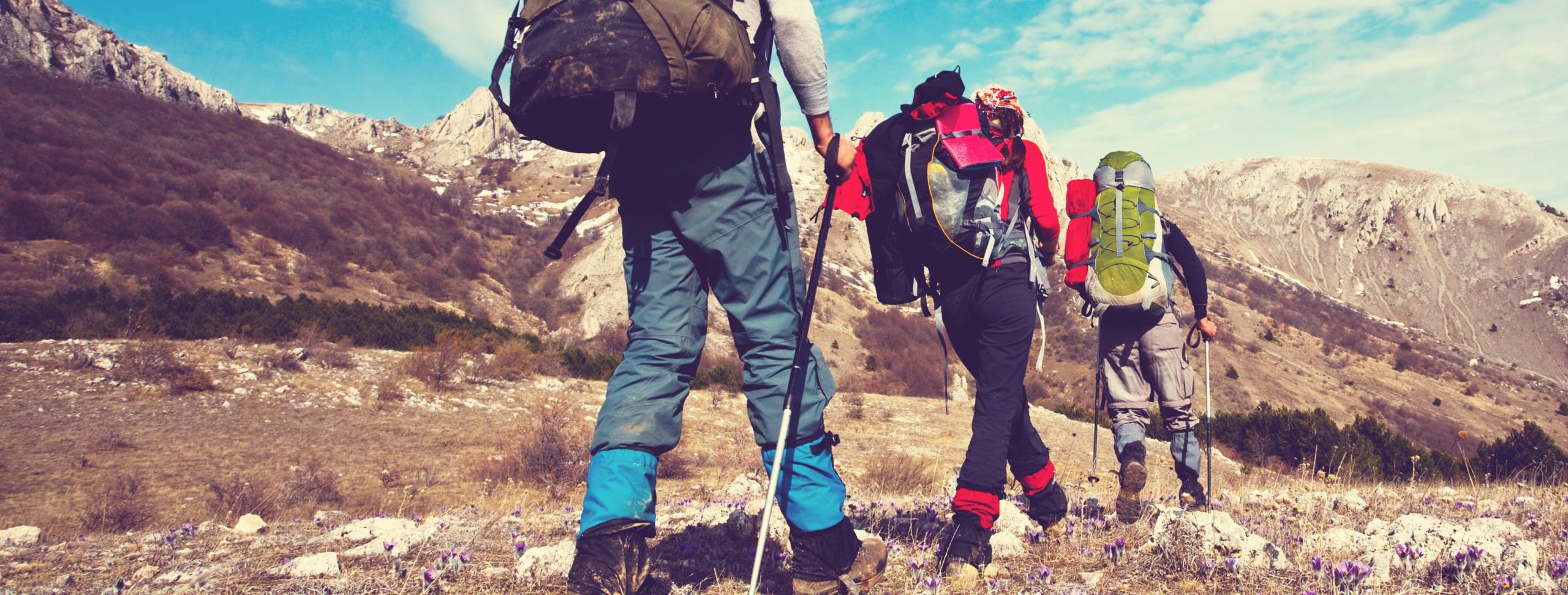
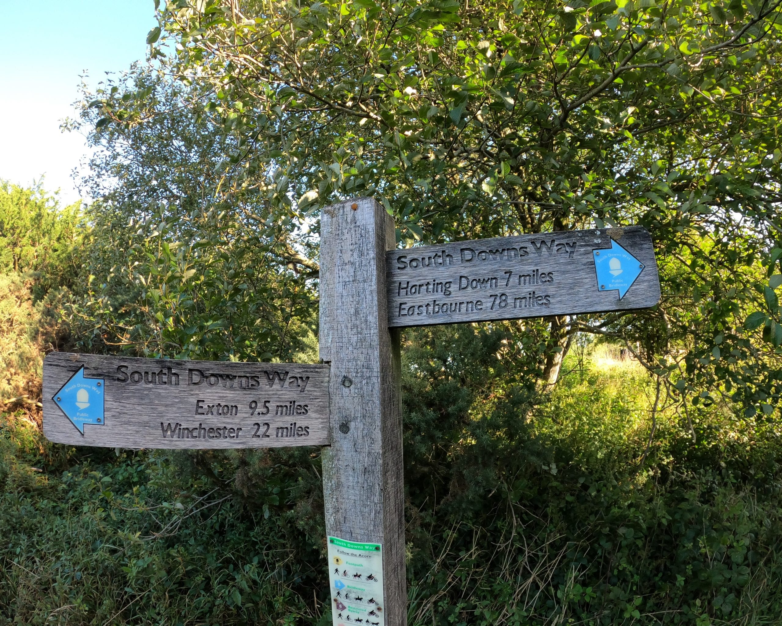
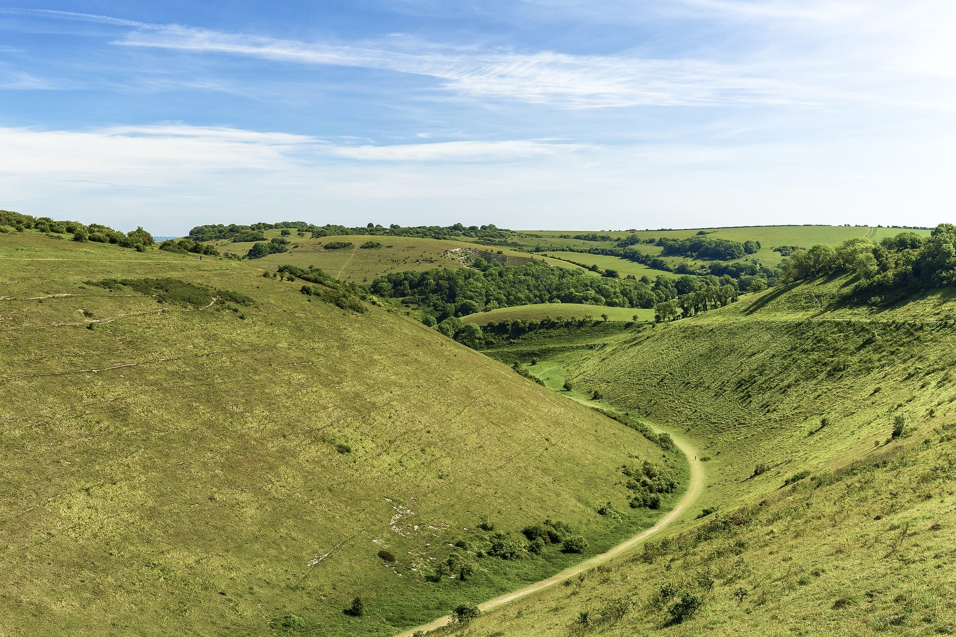
The South Downs Way runs 100 miles along the chalk ridge from Winchester to Eastbourne — the most-walked National Trail in southern England and the one most likely to be the first that London-based walkers attempt. It opened in 1972 and follows old drove roads, parish boundaries and ridge paths along the South Downs escarpment.
What to expect
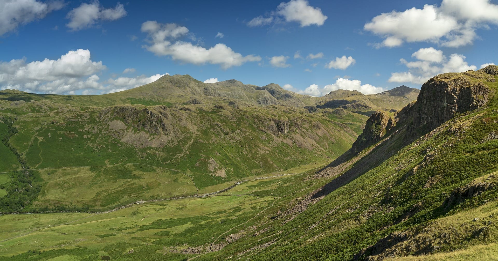
Six to nine days at a steady pace. Daily distances are 12-15 miles with cumulative ascent around 4,200m — honest hill walking but well within the reach of fit walkers. The Seven Sisters cliffs at the eastern end, Devil’s Dyke near Brighton, and the high ground over Bignor Hill are the headline sections. The trail crosses several rivers (the Adur, the Cuckmere, the Ouse) at the few places they cut through the chalk ridge.
Practical notes
Walkable year-round — chalk drains well and the southern coast catches less rain than upland trails. Public transport is exceptional — trains link Winchester, Petersfield, Amberley, Hassocks, Lewes, Berwick, Eastbourne, and several villages in between. This makes the South Downs Way the easiest National Trail to walk in weekend sections. Open access on most of the route means wild camping is technically not permitted, but the Friends of the South Downs maintains a list of farm campsites along the trail.
Stage by stage
The South Downs Way runs 100 miles along the chalk from Winchester in Hampshire to the sea at Eastbourne. It is the gentlest of the long National Trails to walk — a broad, well-signed ridge with no real navigation problems — and one of the most accessible from London. Most people walk it west to east. Broken into natural sections (mileages approximate):
| Section | Distance | Days | Character |
|---|---|---|---|
| Winchester to Buriton | ~24 miles | 1–2 | A soft start through Hampshire farmland and beech hangers, climbing onto the downs proper near Butser Hill — at around 270m the highest point on the whole trail. |
| Buriton to Amberley | ~26 miles | 2 | Open chalk ridge with big views over the Weald, past Harting Down and the Devil's Jumps, dropping to the Arun at Amberley, which has its own station. |
| Amberley to Southease | ~26 miles | 2 | The heart of the downs: Chanctonbury Ring, Devil's Dyke and Ditchling Beacon, the highest point in East Sussex, then down to the Ouse at Southease and its station. |
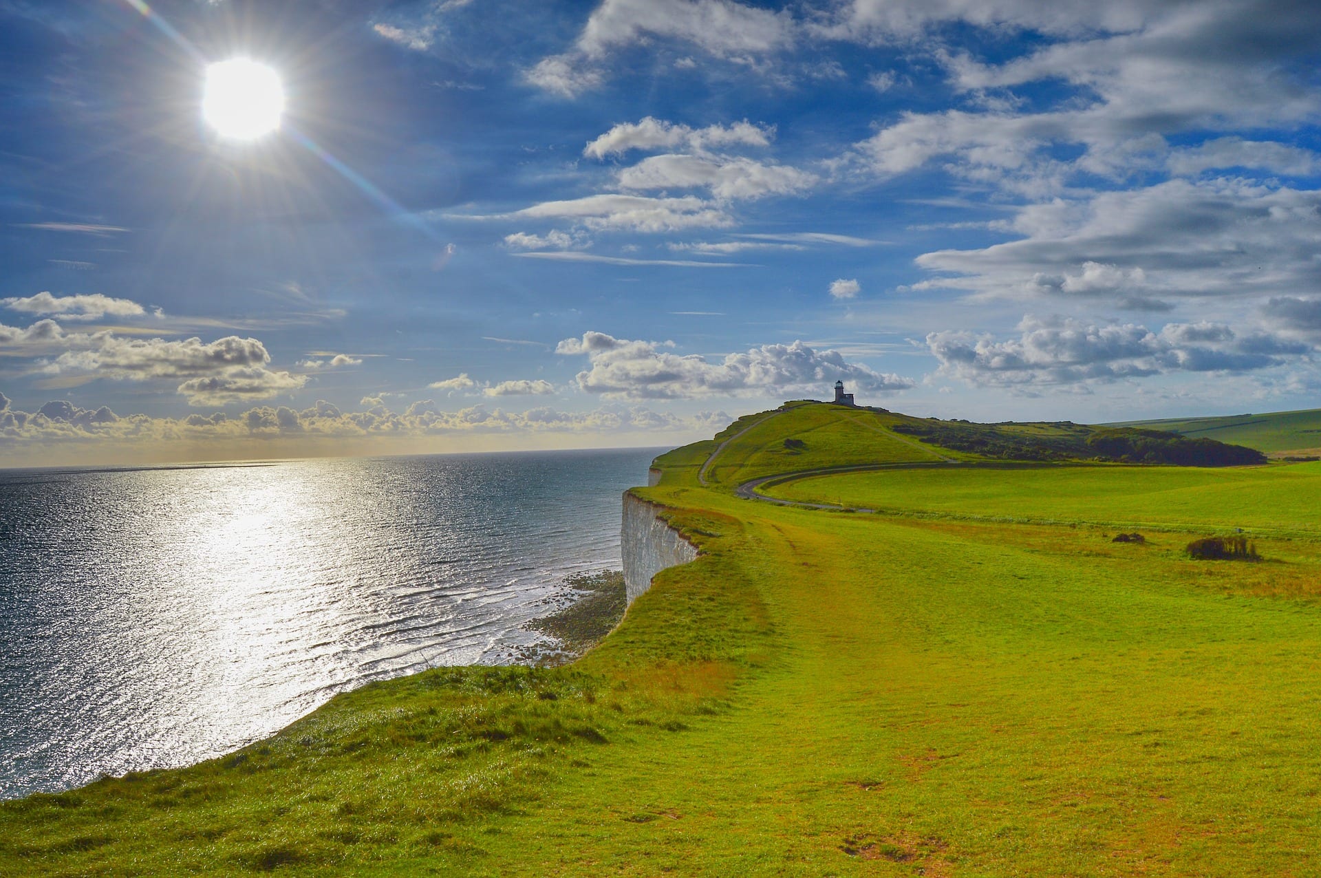
| Southease to Eastbourne | ~24 miles | 1–2 | The finest finish on the trail — the Cuckmere meanders, the Seven Sisters and Beachy Head along the cliff edge into Eastbourne. |
Doing it car-free
The South Downs Way is one of the easiest big trails to reach without a car. Both ends are main-line stations: Winchester is about an hour from London Waterloo, and Eastbourne sits on the line from London Victoria. The trail itself passes directly beside stations at Amberley and Southease, and several more — Petersfield, Hassocks, Lewes — are a short walk or bus below the ridge.
That dense network of stations is what makes the South Downs Way such a good trail to walk in pieces. You can pick almost any two-day stretch, train to one end and home from the other, and never need to arrange a pick-up.
The South Downs Way is one of the most car-free trails in Britain — see how it tops our car-free National Trails index.
Where to stay
The villages below the scarp — Exton, Cocking, Amberley, Alfriston — have a good spread of pubs with rooms, B&Bs and the odd campsite, with bag-transfer services covering the full route. One genuine planning point: the ridge is dry. There are very few water sources on the tops, so fill up in the villages and carry more than you think you need, especially in summer.
Quick answers
How long does the South Downs Way take?
Most walkers take six to eight days for the full 100 miles. It is also a popular off-road cycling and trail-running route, since the whole trail is a bridleway open to bikes and horses.
Which is the best section?
The final stretch from the Cuckmere over the Seven Sisters to Beachy Head is the most dramatic, with stations at Seaford and Eastbourne making it an easy day or weekend on its own.
Can you walk it without a car?
Yes, more easily than almost any comparable trail. Main-line stations at both ends and trackside stations at Amberley and Southease make car-free section-walking straightforward.
When is the best time to walk it?
Late spring to early autumn. The chalk drains fast so it stays walkable in most weather, but the exposed ridge offers little shade or shelter, so pick your conditions in high summer.
Train, parking, drive…
- Train
- Winchester (SW Railway from Waterloo, ~1h)
- Return
- Eastbourne (Southern from London Victoria, ~1h25)
- Parking
- Winchester park-and-ride or Chesil multi-storey
- Postcode
- SO23 9PE
- Drive
- ~1h30 from London
- Car-free?
- Easy (both ends served by mainline)
Transport details are best-effort and worth double-checking on the day — rural buses and station services change with the timetable.
If you’ve got an extra day…
- South Downs paragliding at Airworks or Cloudbase
- North Downs Way as a parallel walk in autumn
- Brighton stop-off at the midpoint
Plan it yourself.
The most authoritative sources we know of for this route — routes, conditions, governing bodies and operators. Open in a new tab.
- South Downs Way - National Trails
- National Trails official body for the 15 long-distance National Trails of England and Wales.
- OS Maps Ordnance Survey for paper sheets and the OS Maps app for route planning.
- Mountain Weather Information Service free upland weather forecasts — the standard reference for British hill walkers.
- Long Distance Walkers Association route database covering hundreds of UK long-distance trails beyond the National Trails network.