
Most British outdoor writing starts from the assumption that you’ve got a car and a day to drive somewhere. Half the country’s outdoor population — the half that lives within reach of a London terminus — doesn’t, and shouldn’t have to.
These five hikes all start and end at a station you can reach from central London in under two hours. None of them require a hire car, a bus connection beyond walking pace, or a stretch of A-road verge to cross. None of them are particularly long. None of them need overnight kit. They aren’t ranked — they’re a starting-point shortlist, ordered roughly south-to-north.
If you’ve done none of them, do the South Downs Way segment first. If you’ve done all of them, drop us a line and tell us what we missed.
A note on what counts as “beginner”: each of these is walkable in trainers in summer, in waterproof boots in winter, and by anyone who can manage 15 km of mixed flat-and-rolling ground in a day without needing to stop every hour. None involve scrambling, navigation harder than following waymarks, or any meaningful exposure.
1. The South Downs Way — Lewes to Eastbourne
Distance: 22 km · Ascent: ~520 m · Train: London Victoria → Lewes (1h05) · return Eastbourne → London Victoria (1h25)
This is the easternmost segment of the South Downs Way National Trail, and the best argument for the line that the South Downs is England’s most generous chalk ridge. You’re on open downland from the moment you climb out of Lewes to the moment you drop into Eastbourne, with the Seven Sisters cliffs as your finale.
You start at Lewes station, walk through the town to pick up the Downs above Cliffe Hill, and then it’s a steady ridge walk east through Firle Beacon (217 m), Bo Peep, Alfriston (the natural lunch stop — the Star Inn or the George Inn, both pre-Tudor pubs), and on up over the Seven Sisters to Birling Gap. From Birling Gap you can either drop into Eastbourne via Beachy Head, or pick up the cliff bus if the legs are gone.
It’s mostly above 100 m once you’re on the ridge, so the views run the entire way — the English Channel to the south, the Weald to the north. The chalk drains well so it’s walkable in winter; just budget more time and a head-torch from October to March if the days are short. Wind is the variable: there’s no shelter on the ridge once you’re past Firle.
Why it’s beginner-perfect: you literally cannot get lost. Acorn-marked signs every 200 m, no junctions you can fluff, a clear linear route between two stations. Buy a sandwich at Lewes station and you can be on the ridge within 25 minutes of stepping off the train.
What can go wrong: the day in summer can hit 28°C with no shade. Carry 2L of water, a hat, and don’t underestimate how hot a chalk path reflects when the sun’s out. In winter, the wind makes the wind-chill more relevant than the air temperature — an extra fleece doesn’t go amiss.
2. The Thames Path — Henley to Marlow
Distance: 13 km · Ascent: negligible · Train: London Paddington → Henley-on-Thames (1h05, change at Twyford) · return Marlow → London Paddington (1h10, change at Bourne End and Maidenhead)
The Thames Path is the country’s gentlest National Trail and this stretch is the most-walked section of all 184 miles. It’s almost flat, follows the river the entire way, and crosses some of the prettiest small towns in southern England.
From Henley station, walk down to the river through the regatta course and follow the path east. You’ll go past Hambleden Lock (one of the most photographed locks in England), the model village of Aston, the long meander round Temple Lock and finally into Marlow itself. Most of the path is the actual towpath; sections cut inland briefly through estate land and reconnect with the river at the next lock.
Lunch is at any one of about a dozen riverside pubs — the Flower Pot at Aston, the Stag and Huntsman at Hambleden, the Hand and Flowers in Marlow if you’ve booked weeks ago. The Compleat Angler at the Marlow end is the famous tourist option.
Why it’s beginner-perfect: flat, scenic, lots of bail-out options if you’ve over-estimated your day. The path is unambiguous. The pubs are excellent.
What can go wrong: after heavy rain the section between Mill End and Hurley can flood — not impassably, but you’ll get wet feet. Check the Environment Agency river-level page for Maidenhead before you go in winter. Summer weekends are crowded with rowers, dog-walkers, paddleboarders and weekend cyclists; either go early or go midweek.
3. The North Downs Way — Otford to Sevenoaks (with a Knole Park finale)
Distance: 14 km · Ascent: ~380 m · Train: London Charing Cross → Otford (45 min) · return Sevenoaks → London Charing Cross (35 min)
The closer-to-London option, and the one most south-east Londoners can do as a day off from work without anyone noticing. The North Downs Way at this point runs through chalk woodland, open downs and the edge of the Sevenoaks AONB.
Otford is a pretty Kent village three minutes’ walk from the station. You pick up the North Downs Way on the village green and head east, climbing through Otford Mount, contouring along the ridge through Kemsing and Wrotham, then traversing south above Sevenoaks itself. The official Way continues east toward Wrotham, but for this loop you drop south at Otford Mount to pick up the path through Knole Park — the National Trust estate with the herd of 350 deer, ancient oaks, and the largest English country house in private hands.
Knole Park is the highlight of the walk. The deer are habituated and you’ll typically get within 30 m. The mansion (open spring through autumn) is worth an hour on its own; the park is free and open year-round, dawn to dusk.
Why it’s beginner-perfect: Charing Cross to trailhead in 50 minutes total. The Way is well-marked; Knole Park is signed once you’re in it; Sevenoaks station is 15 minutes’ walk from the park exit. Hard to mess up.
What can go wrong: the chalk woodland turns to slick clay-on-flint after rain, and the climb out of Otford is steeper than the contour map suggests. Decent walking shoes are doing more work here than on either of the first two routes.
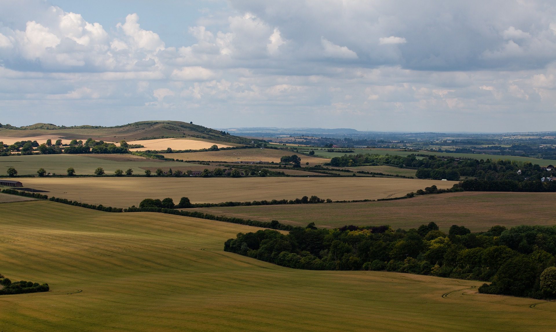
4. The Ridgeway — Tring to Ivinghoe Beacon
Distance: 10 km · Ascent: ~210 m · Train: London Euston → Tring (40 min) · return Tring → London Euston (40 min, same station; this is an out-and-back)
The Ridgeway is Britain’s oldest road — an 87-mile chalk path that’s been walked for at least 5,000 years. Its eastern end is Ivinghoe Beacon, a 233-metre Iron Age hillfort with one of the best views in the Chilterns. From London, the easiest way to walk a meaningful section is to take the train to Tring, walk the last 5 km of the Ridgeway out to Ivinghoe Beacon, and walk back.
The path runs north out of Tring across the canal, through Aldbury (a textbook English village with a duck pond and two pubs), then climbs gently through Pitstone Hill and the Bridgewater Monument estate. Ivinghoe Beacon itself is the obvious turnaround point — you can see Aylesbury, Leighton Buzzard and the Vale of Aylesbury laid out below.
Aldbury, on the way out and the way back, is one of the more useful lunch options on this list. The Greyhound Inn is a 16th-century coaching inn with a working forge across the road and a beer garden that looks at the village green. Worth the small detour.
Why it’s beginner-perfect: short total distance, a real summit at the turnaround (which makes it feel like more of a walk than its kilometre count would suggest), and a single-station return trip means no need to coordinate two different train tickets. Trains run every 30 minutes from Euston.
What can go wrong: Ivinghoe Beacon is exposed in winter; the wind on the top can be twice the speed at Tring station. Pack a windproof. The Bridgewater Monument is open weekends only; check before assuming you can go up the tower.
5. The South West Coast Path — Exmouth to Budleigh Salterton
Distance: 11 km · Ascent: ~330 m · Train: London Paddington → Exmouth (3h, change at Exeter St Davids) · return Exmouth → London Paddington (same)
This one is a stretch — three hours each way is the longest train day on this list, and three hours is enough to make it a candidate for an overnight if you’d rather spread the day. But it’s also the only entry that gets you onto the South West Coast Path, Britain’s longest National Trail at 630 miles, without renting a car.
You take the GWR direct to Exeter St Davids, change onto the Exmouth branch line (every 30 minutes; 28 minutes journey), step off at Exmouth and the path is at the end of the platform. You walk east along the seafront, climb out of Exmouth onto the red cliffs of the Jurassic Coast, contour east along the clifftop through Orcombe Point and Sandy Bay, and drop into Budleigh Salterton (population 5,000, full of Victorian villas and a famous pebble beach). The 157 bus runs every 30 minutes back to Exmouth station from Budleigh. Train from there back to London.
The geology is the point of this walk. The Jurassic Coast section here is the oldest of the formation — Triassic red sandstone, 250 million years old — and you’re walking along an exposed cliff section that looks fundamentally different from any chalk or limestone landscape in southern England. Fossil enthusiasts will lose hours.
Why it’s beginner-perfect: the clifftop path is well-engineered (this is a flagship National Trail), the navigation is “keep the sea on your right”, and the bus saves you from having to do the same path twice. The walking is rolling without ever being technical.
What can go wrong: if you’ve got a fear of cliff-edges, this is the wrong walk — some of the path is genuinely close to the drop, and the cliffs above Sandy Bay are unstable. Stay back from the edge and keep dogs on a lead. Also, GWR’s services to Exeter are reliable but the Sunday timetable thins out; check the return train before committing if it’s a Sunday day-trip.
Kit notes for any of these
You don’t need anything special. None of these walks are above 250 m. None involve scrambling. None go beyond the reach of mobile phone coverage. A day pack with water, food, a waterproof, a thin spare layer, a hat, and your usual phone-charger-and-keys is genuinely all you need.
If you’re tempted by the cheaper-than-the-train cost of driving, do it once and then never again — finishing at a different station from where you started turns any walk from a logistical chore into a real point-to-point line on a map. That’s the simple advantage of these five over the equivalent suburban-car-park walks: you actually go somewhere.
What’s next
If you’ve done two of these, you’re ready for The Cotswold Way (102 miles, but easily walkable in 6-day chunks), The Pennine Way (268 miles, the original UK long-distance path), or The Coast to Coast (192 miles, the most-loved unofficial route in Britain).
If you’d rather stick to single-station day-trips, the South Downs Way, North Downs Way, The Ridgeway and Thames Path each have multiple sections within day-trip range of London. We’ll cover the next five in a follow-up.
Got a beginner London-by-train hike we’ve missed? Drop us a line — that’s how this list grows.